Hi there! If you're just getting started with UkrBIN? Check out Getting Started for some of the site's features. If you have a question about the site, please peruse the FAQ below. If you're still looking for answers, please email us at ukrbin.info@gmail.com or UkrBIN group, and UkrBIN Forum.
Registered users can browse, contribute and download data, learn and share their knowledge on identification, occurrence and natural history of living species.
1) create login (use Latin letters and digits)
2) password (should not contain less than 4 symbols)
3) repeat password
4) enter your current e-mail address
5) enter acknowledgement code from the picture on the left hand side
6) press continue
If your registration has not been confirmed via e-mail, please check the following:
1) check your e-mail address spelling
2) check spam folder in your e-mail box
If you failed to resolve this issue, please contact us ukrbin.info[at]gmail.com with message subject: "I failed to complete registration on the website"
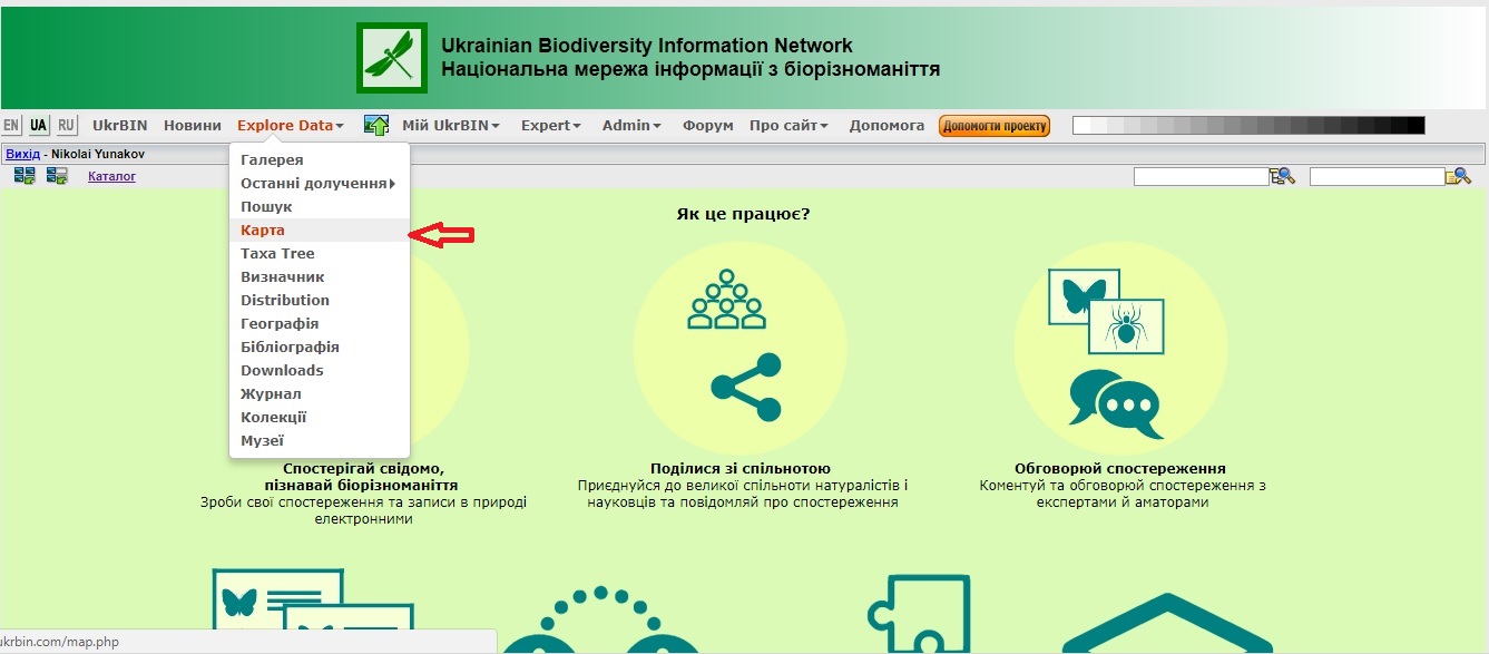
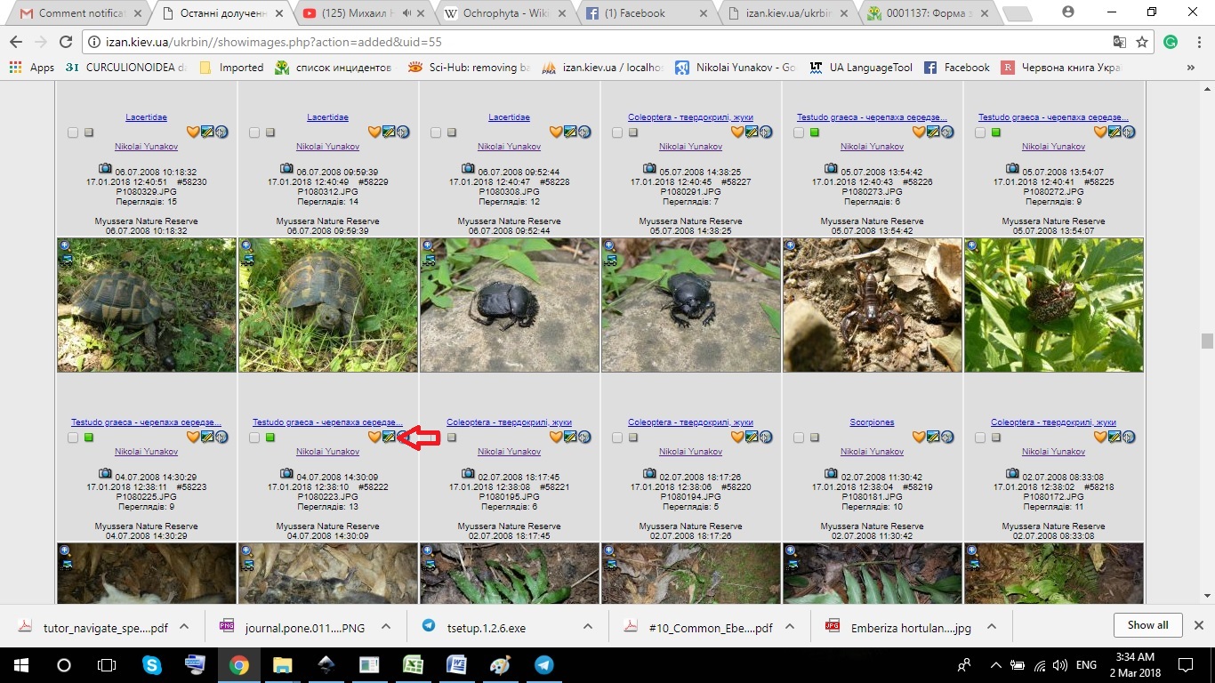
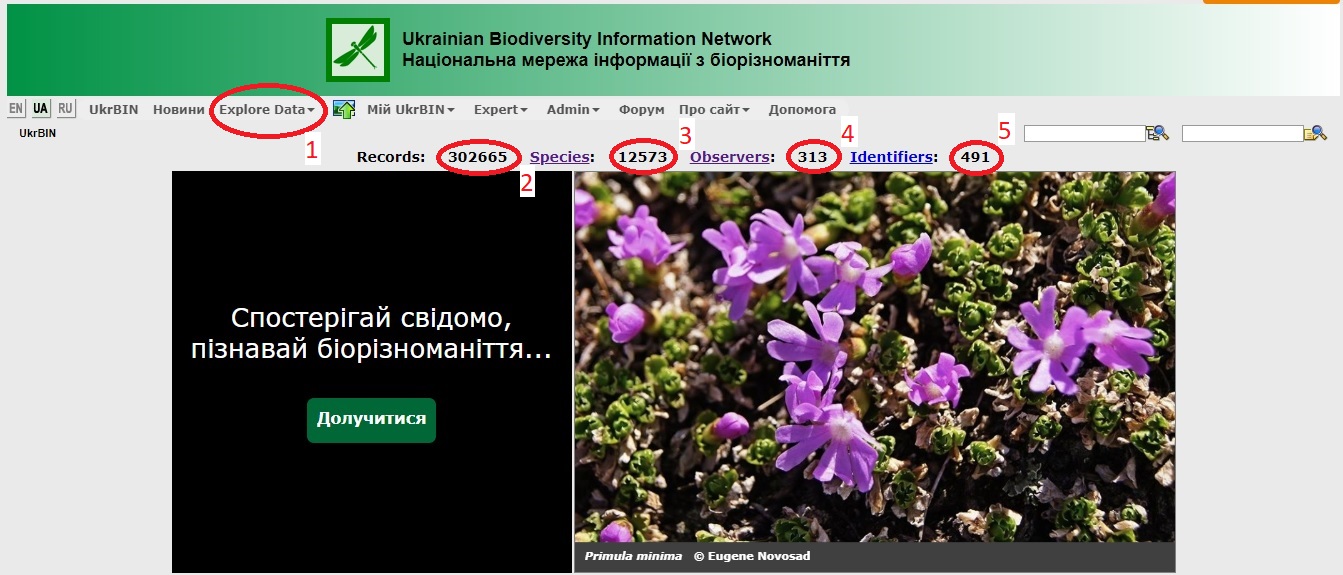
From main menu go to Explore data > Gallery. Select required macrotaxon (Animals, Plants... etc.) press thumbnail image or find required taxon using Search taxa - in right upper corner of the page. Recent observations and Recent comments are available from Gallery page (press more... to see all images or comments)
Press "Upload image" from main menu, or select from "My UkrBIN"
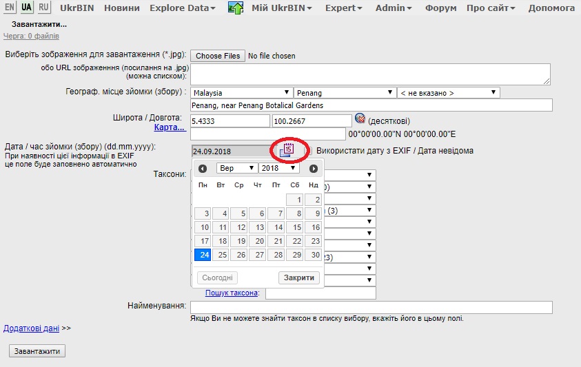
Select image(s) and fill data into the form
Select image(s) from device
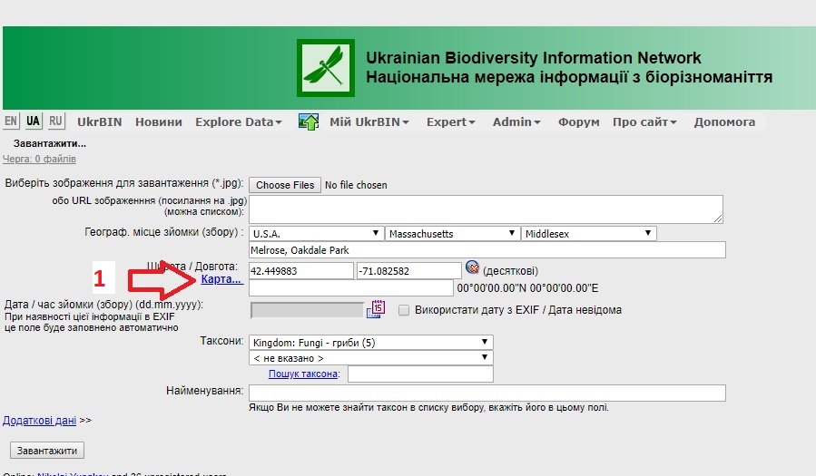
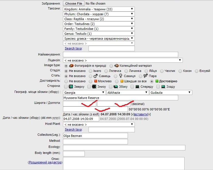
Select: Country, Province (State), District (County), name of your locality
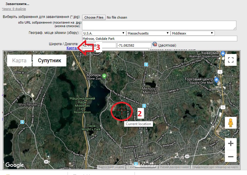
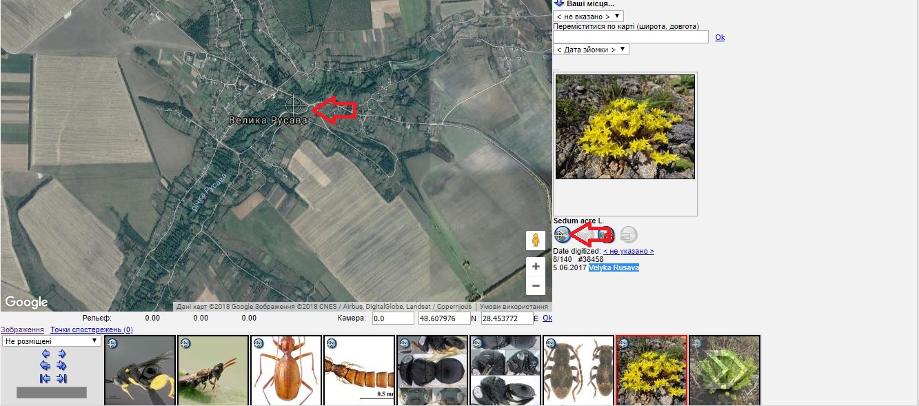
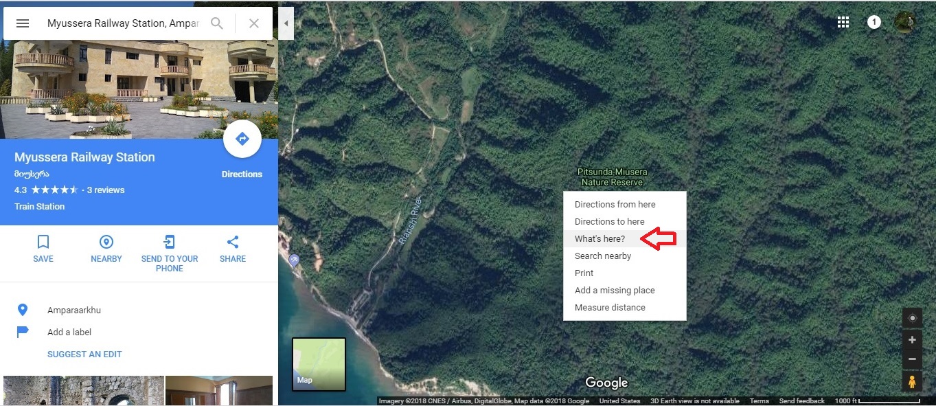
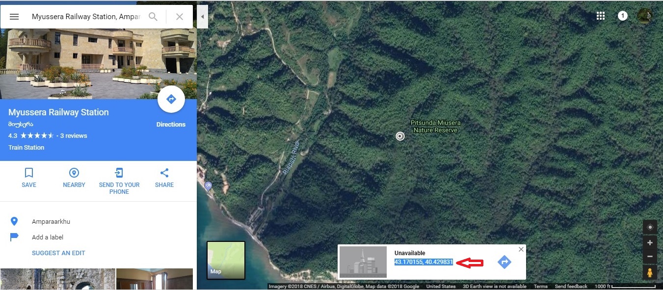
Add coordinates using Map... (3а) or manually, in decimal [36.989213, 84.231474] or standard format [36°59'21.2"N 84°13'53.3"E].
Coordinates may be measured using GPS device, mobile GPS app, e.g. Handy GPS,
and Google Maps
Select date manually or automatically (check "Use date from EXIF")
If you know, select a name of the taxon, from the Search taxa field otherwithe select macrotaxon from the list: "Animals", "Plants" etc.
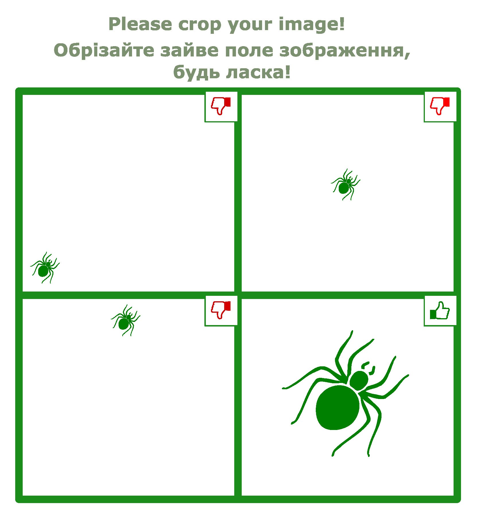
Sometimes it becomes necessary to reload (overwrite) a photo that was uploaded incorrectly. For example, you need to crop extra fields, expand the photo, or upload another photo instead of the existing one.
Prepare the image (on your device) which you want to upload instead of the old image
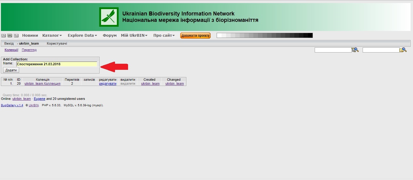
The projects document data on observations without photos and/or collection records. Any registered user can record current or past observations (from field notebooks, lab papers, museum catalogues) via single records or datasets in CSV file.
Project has hierarchic structure as follows.
Project1 >
List1
List2...
Project2 >
List1
List2...
Project contains one to many lists.
Project and list name may be changed.
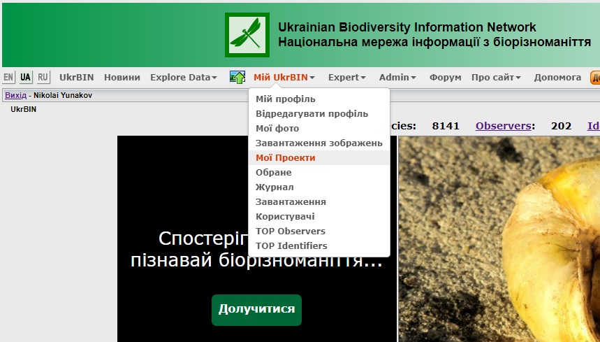
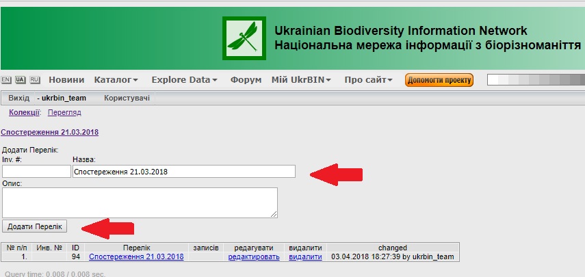
List contains records or datasets in CSV file Menu: My UkrBIN > My Projects
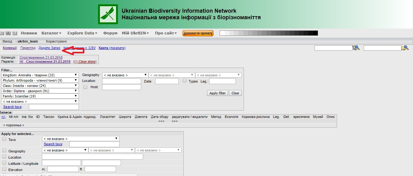
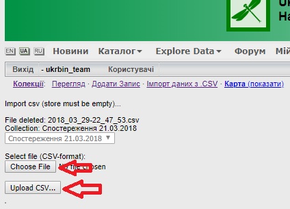
IPT (Integrated Publishing Toolkit) allows uploading of dataset with multiple records into UkrBIN database. The tool automatically reads and verifies data from external file. The system alerts about errors occurred (e.g. taxa missing in internal database). If you experienced problems while uploading data via IPT please contact ukrbin.info@gmail.com
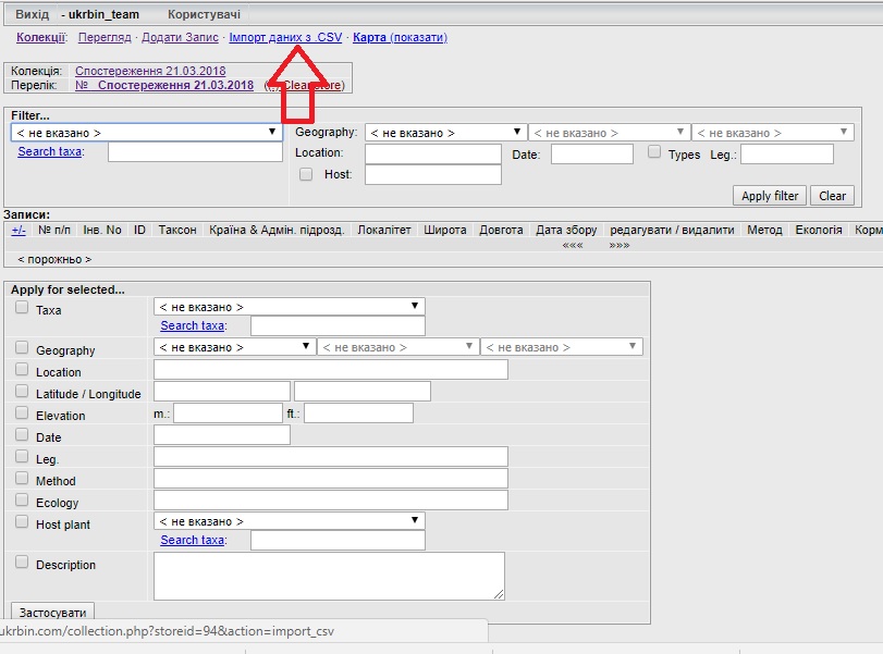
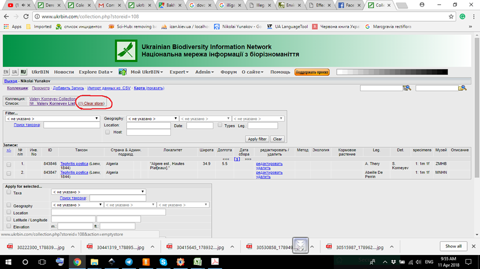
Press Import data from CSV to start uploading a dataset Delete list from the project
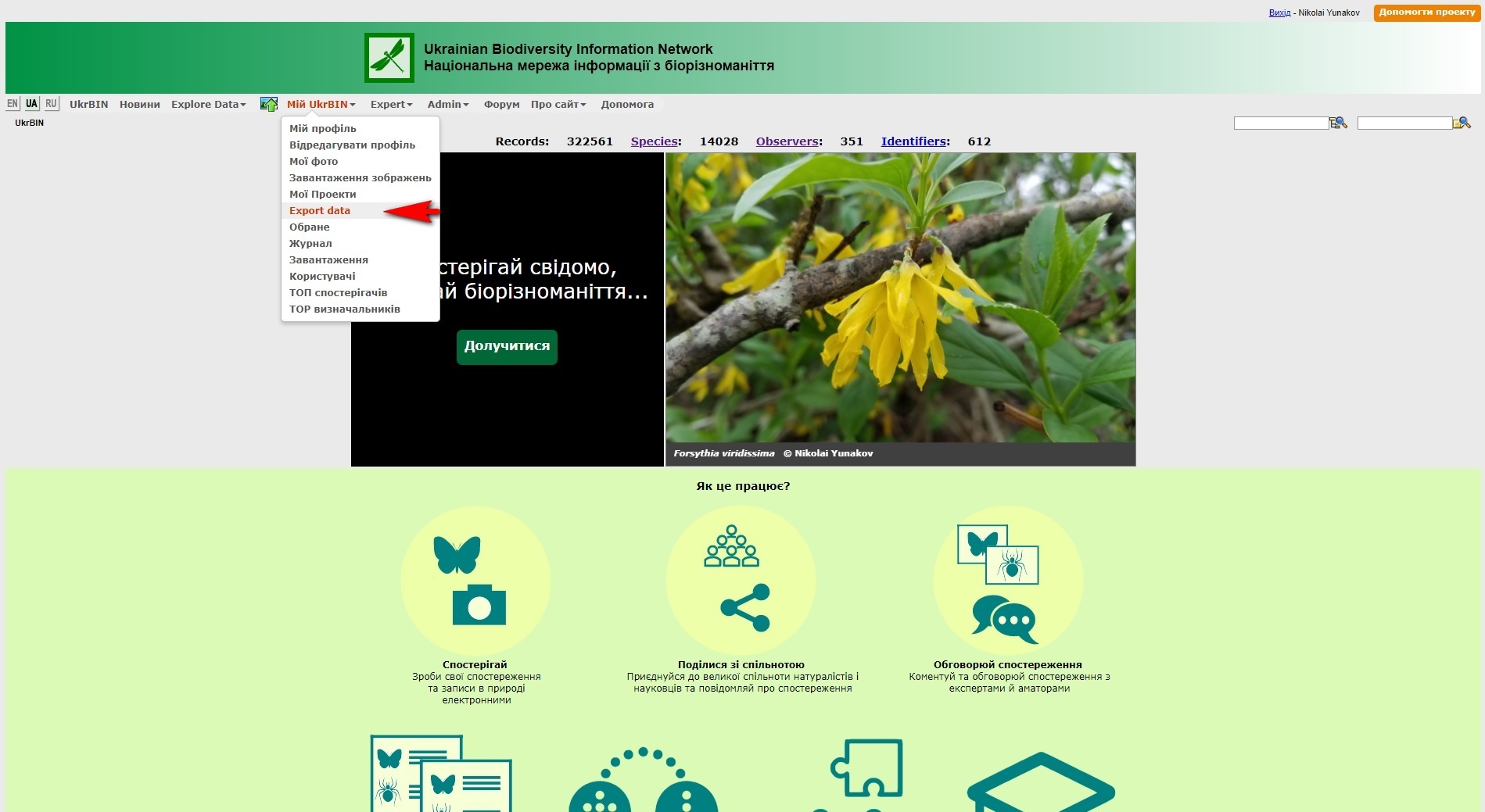
Any registered user who accepted Terms of use, can download raw occurrence data from UkrBIN for further scientific or educational purposes.
Select Export data from My UkrBIN submenu. Press if you need entire dataset, otherwise find and select certain taxon in Search taxa.
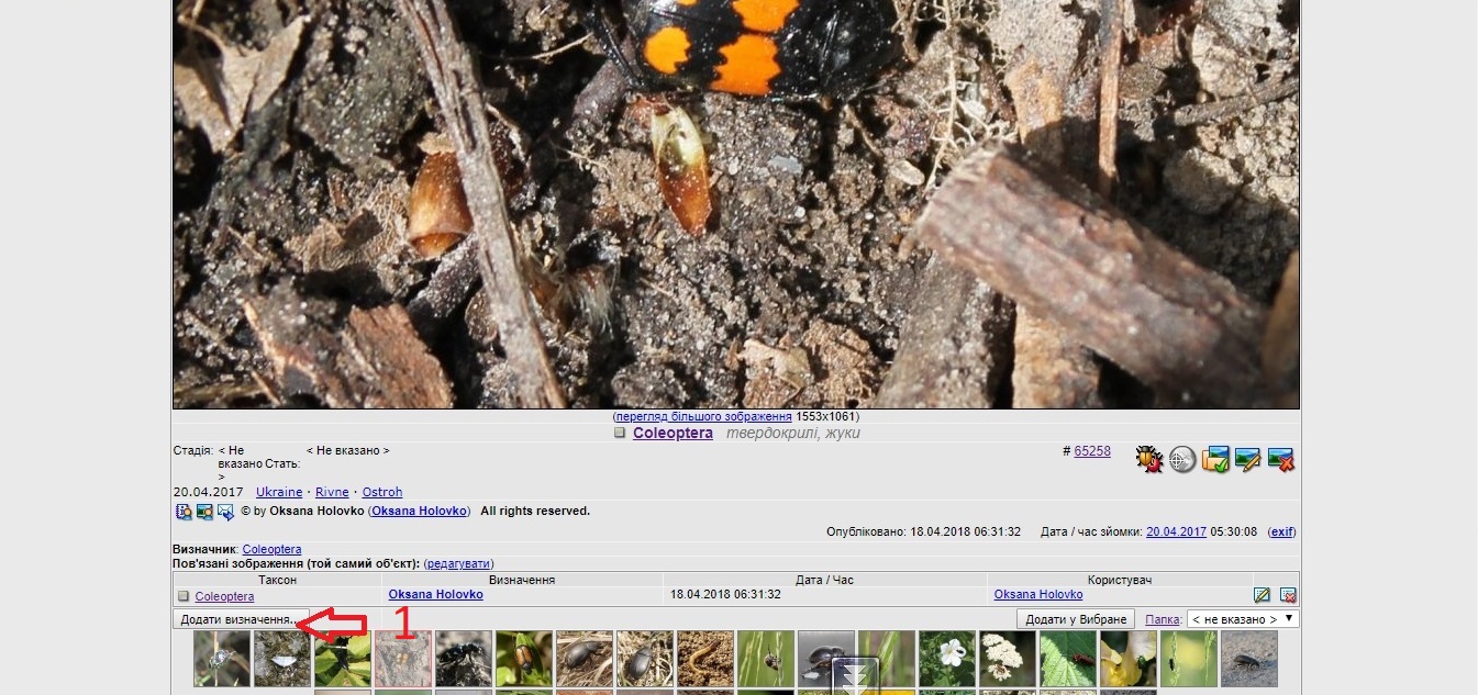
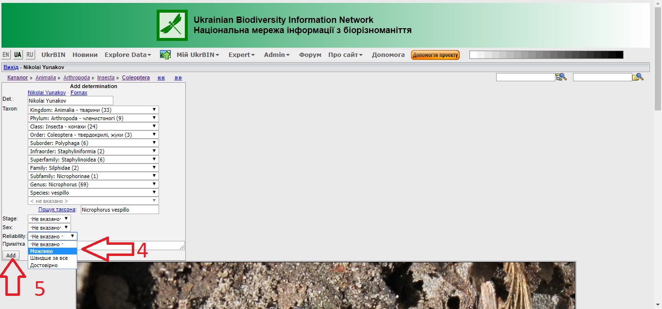
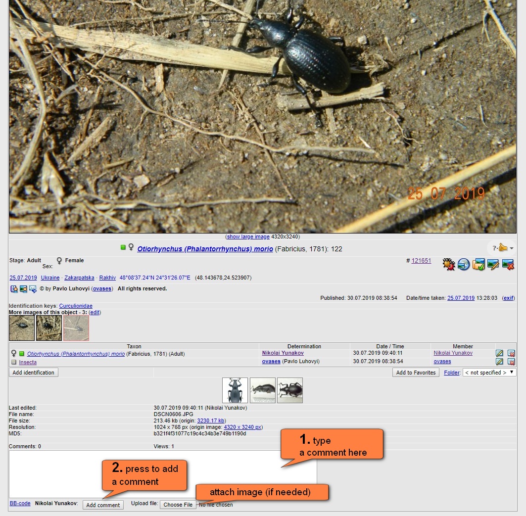
How to add Identification? Any registered user can add identification. Group experts verify identification then.
Once signed up you are enabled to add id for your and photos of others and suggest realibility.
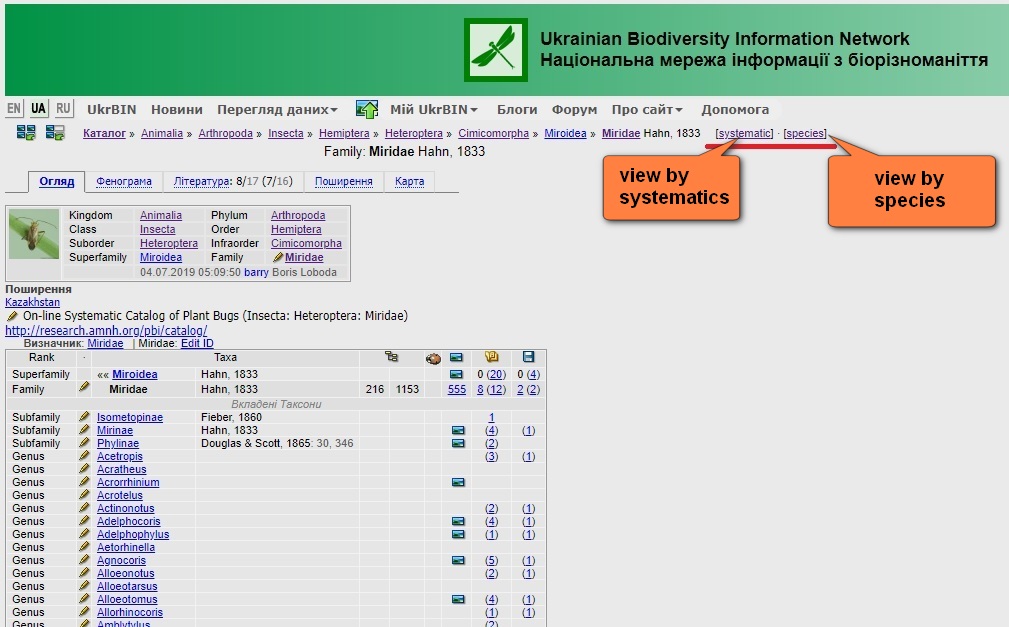
Taxon tree Navigator. It allows quickly jump to higher taxa
Taxon Name. Latin and common name(s) in English (if available)
Data Tabs. Overview, Observations, Phenogram (Phenology), References, Distribution, Map
Original combination (Basionym). Genus combination and spelling as in original description
Synonymy. Junior synonyms, homonyms, misspellings, misidentifications, etc.
Taxon tree table. Shows taxonomic position
Distribution. It shows distribution for Countries (Adm1), States, Provinces Adm2) and Counties, Districts (Adm3), Native Status and Regional Protected Status
Associated Taxa. It shows Biological links (herbivore-host plant) (Learn more)
Identification Keys. Jump to Identification Keys (available in Russian and Ukrainian only)
Similar species. List of morphologically similar species helps in identifications
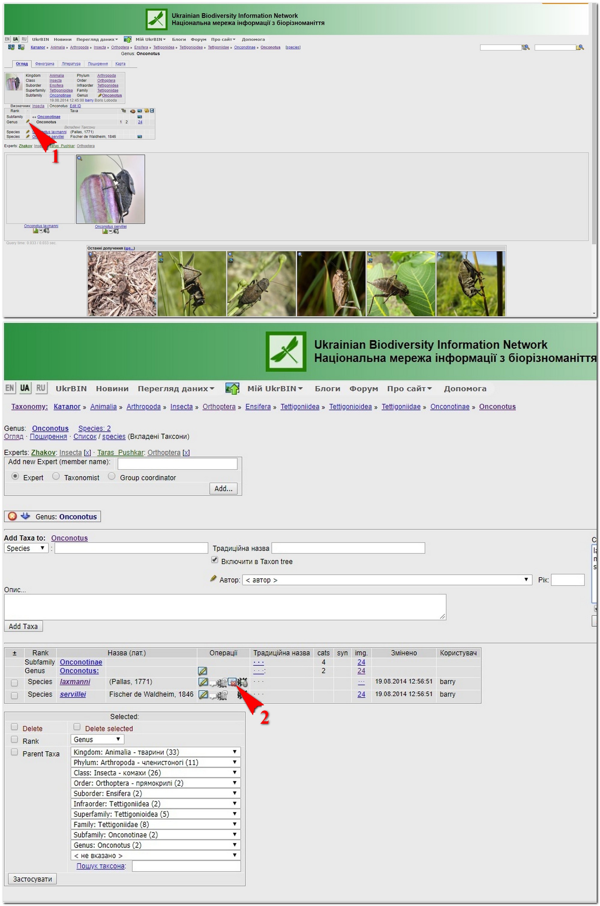
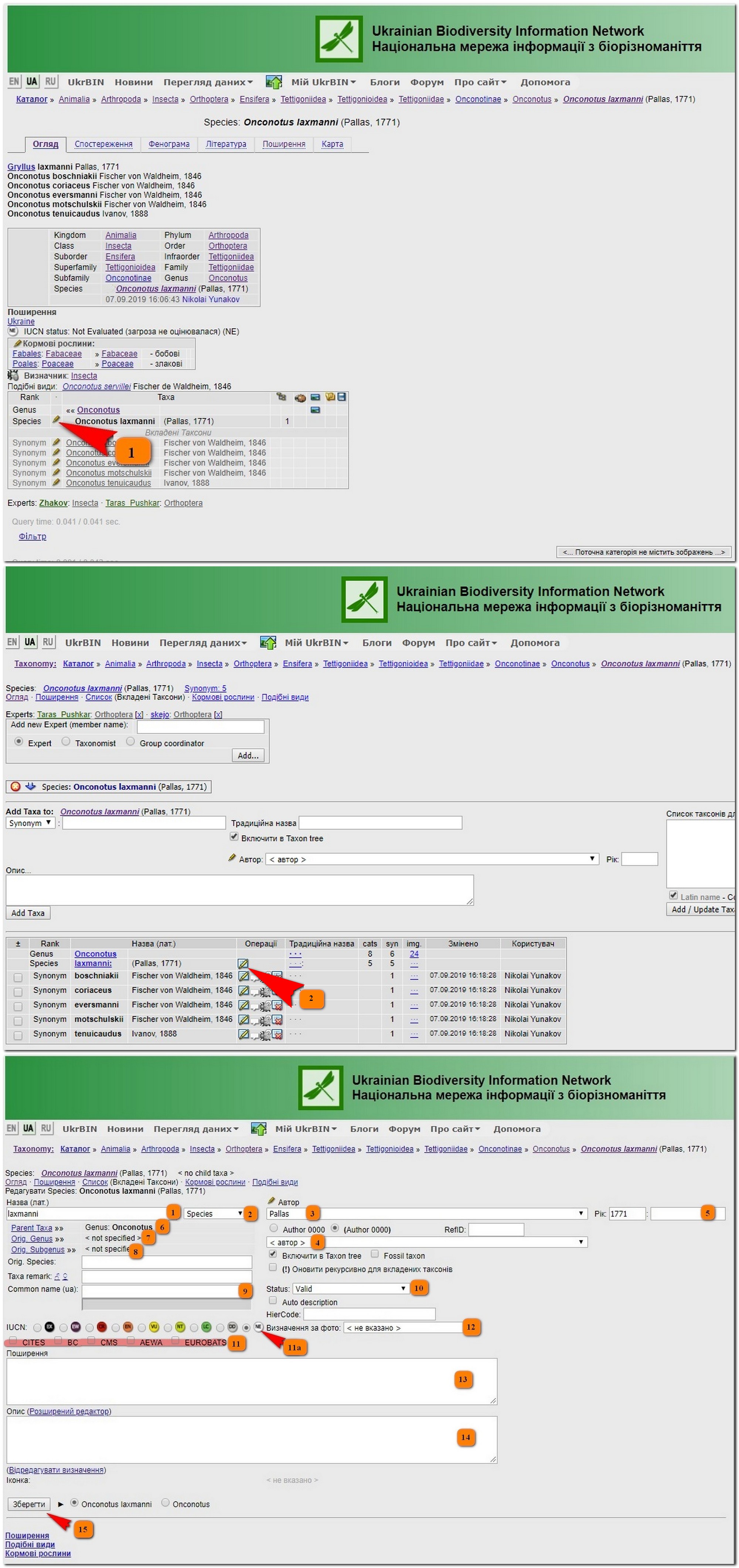
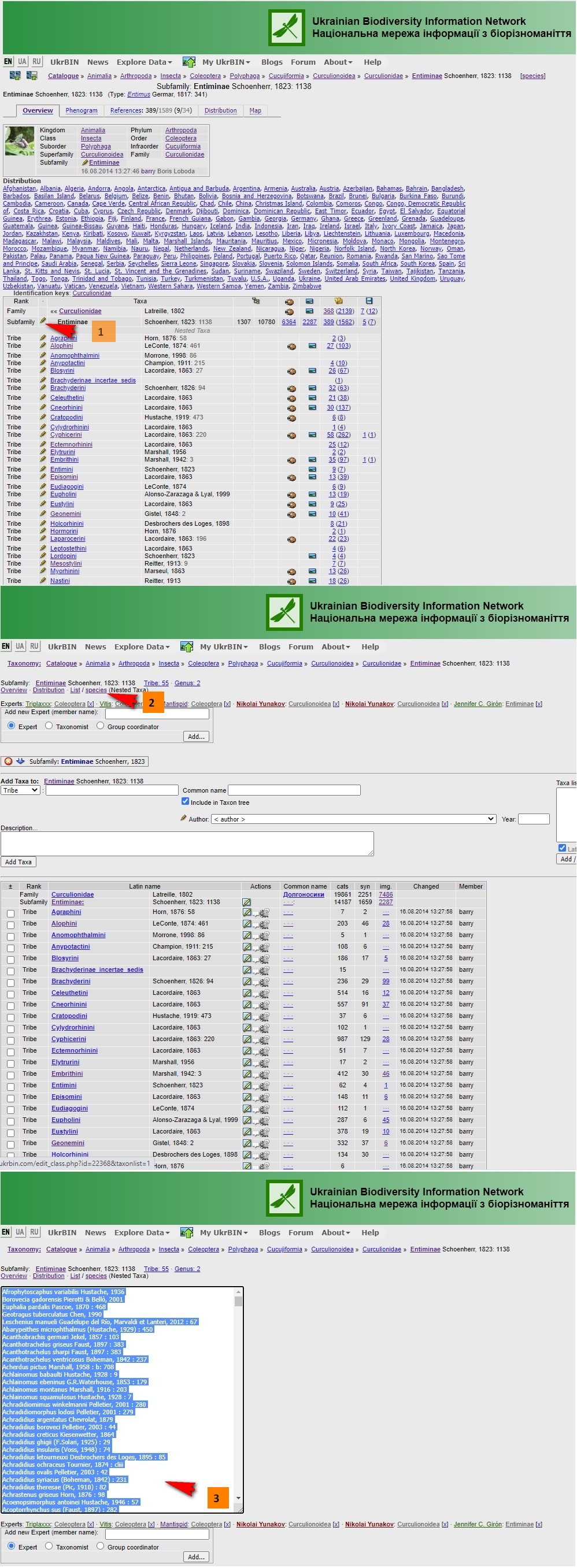
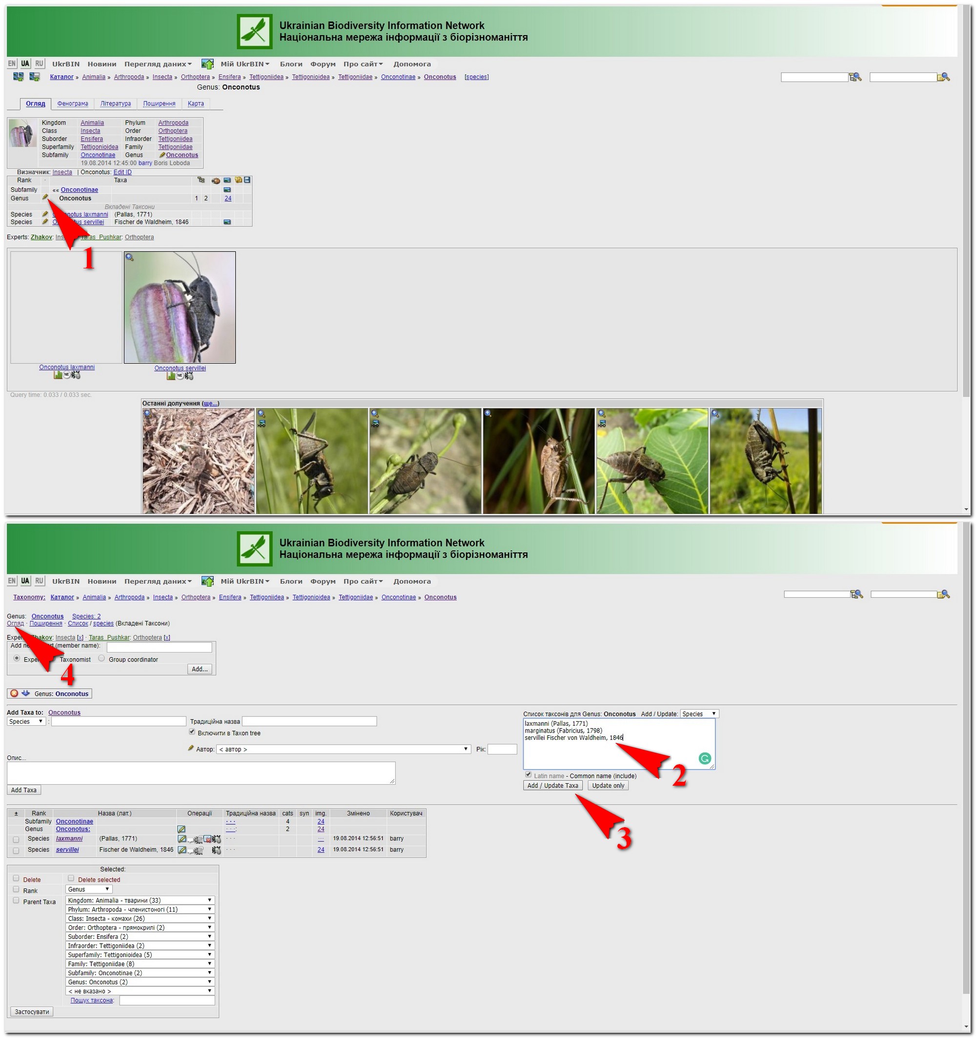
Taxon Editor. Click and go to Taxon Editor of this one and nested taxa
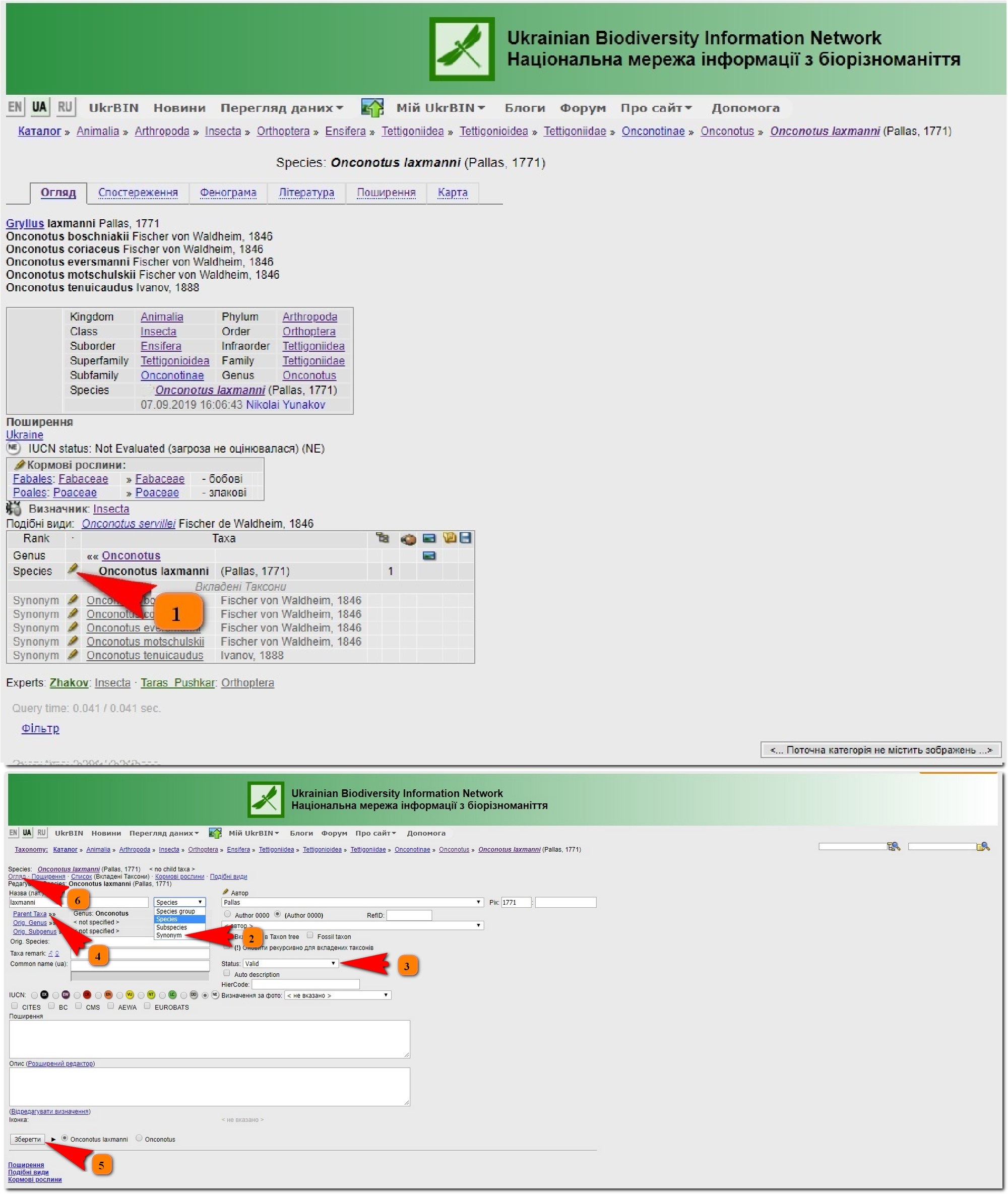
E.g. Peritelus rustica was transferred to the genus Pseudomeira hence the original spelling to be corrected from "rusticus" to "rustica"
How to fix original spelling in the taxon summary?
Open taxon profile and switch to Edit mode: click
Add original spelling "rusticus" to Orig. Species: Field
Save
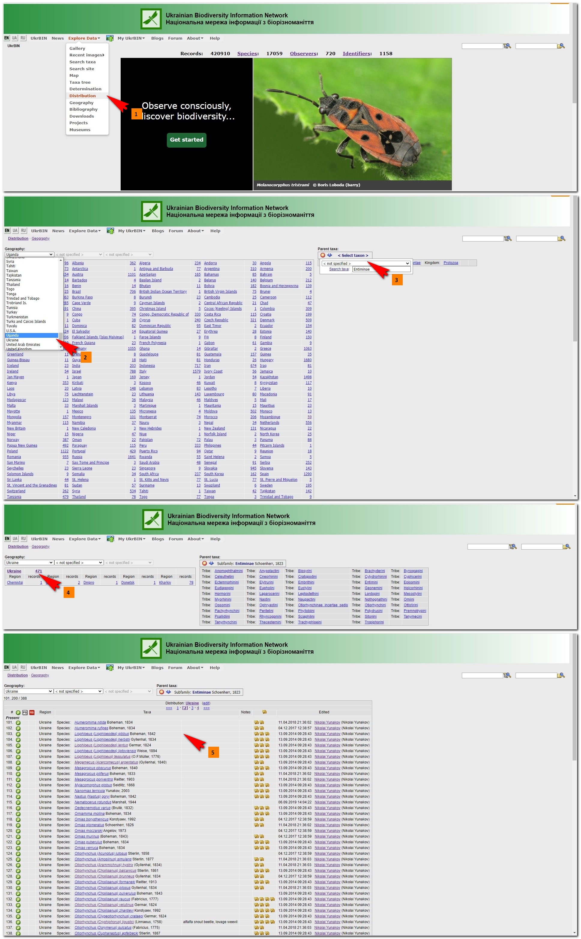
1 Click (added before)
2 click this link (number of related taxa) to open reference in edit mode
3 open Distribution list tab
4a select country and species
or 4b add a list of species
5 save


 in right upper corner of the page. Recent observations and Recent comments are available from Gallery page (press more... to see all images or comments)
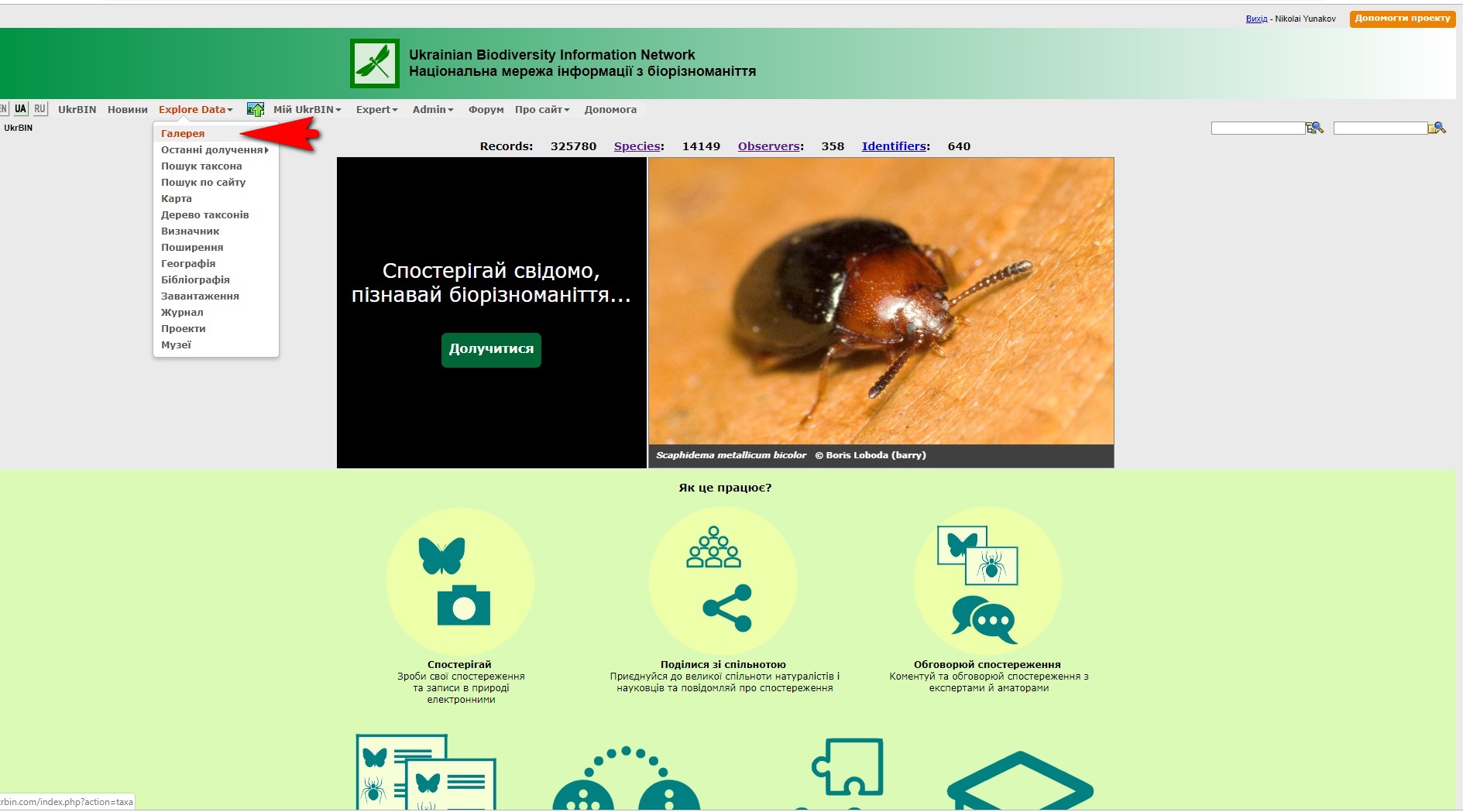

 in the upper left corner to preview enlarged image
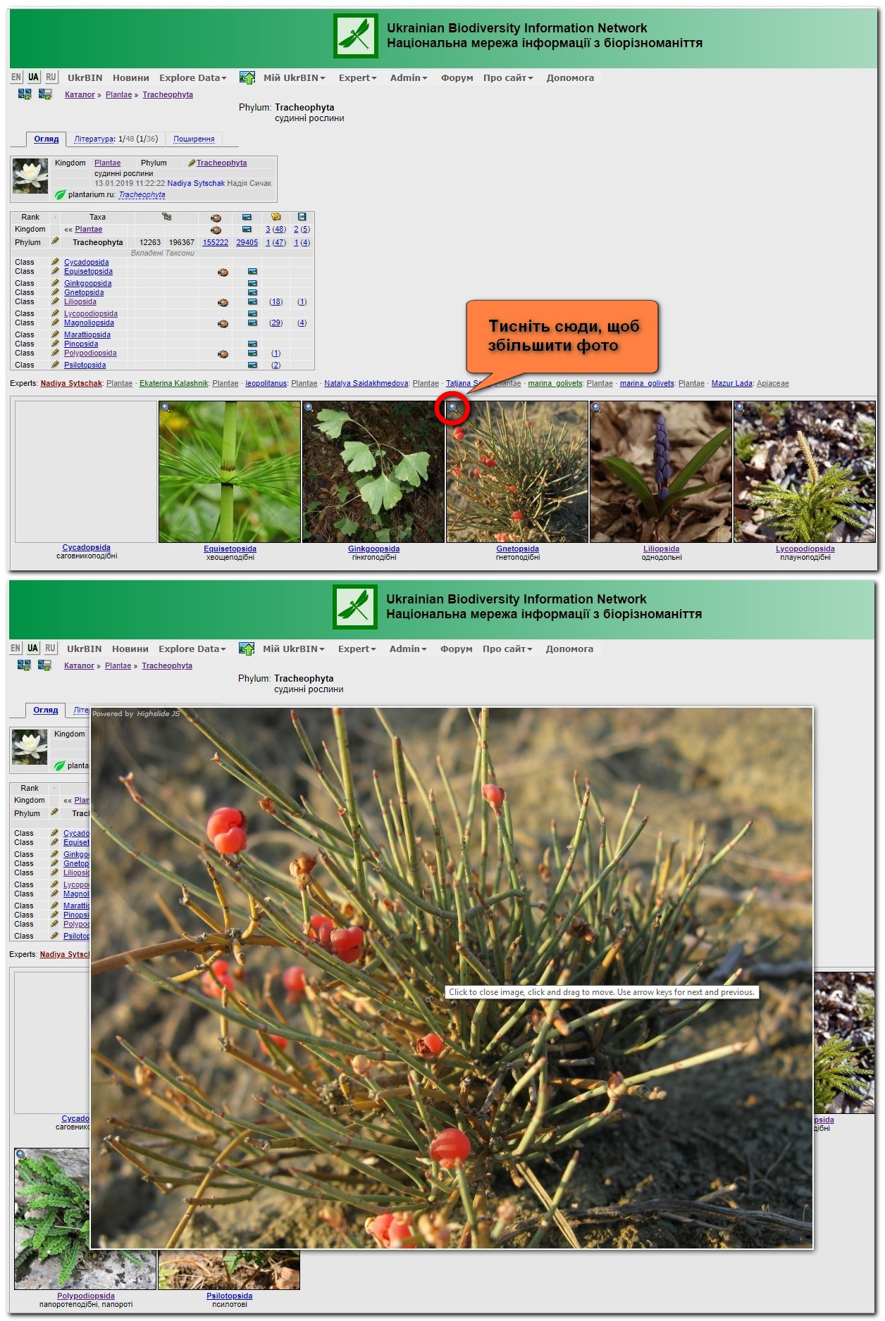
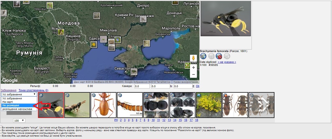
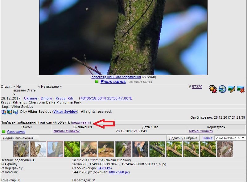
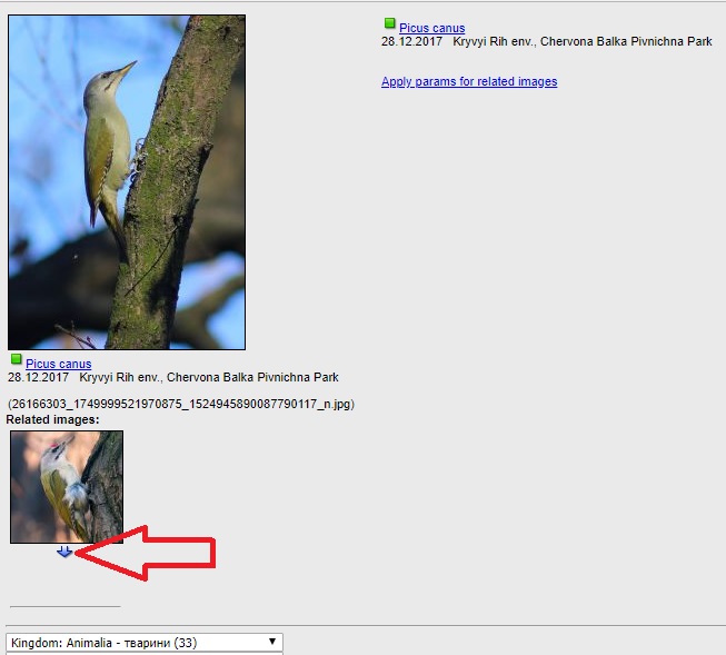
 to compare two images (1). Type taxon name andfind and press Search taxa (2). Select image to compare (3)
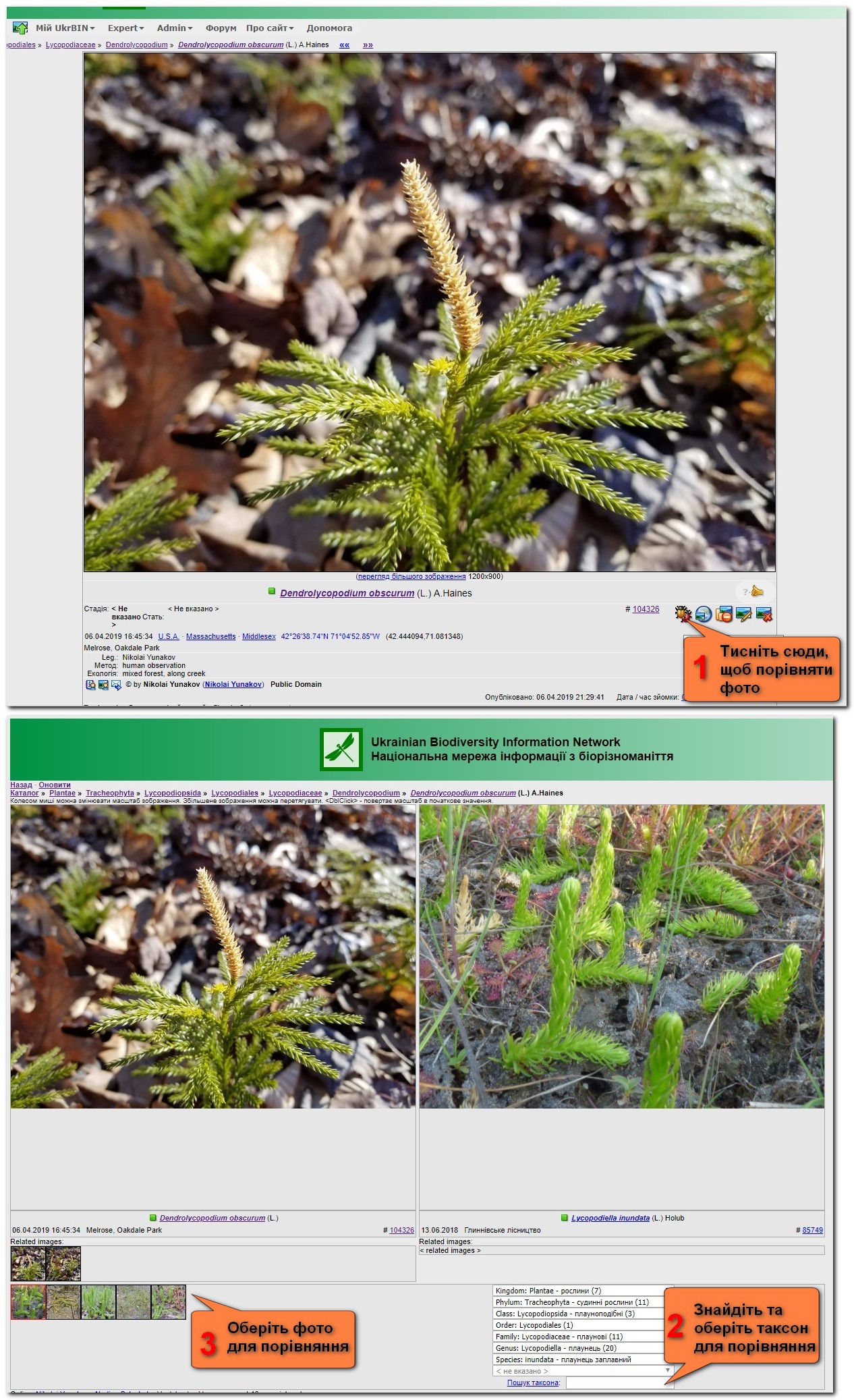
 "Upload image" from main menu, or select from "My UkrBIN"
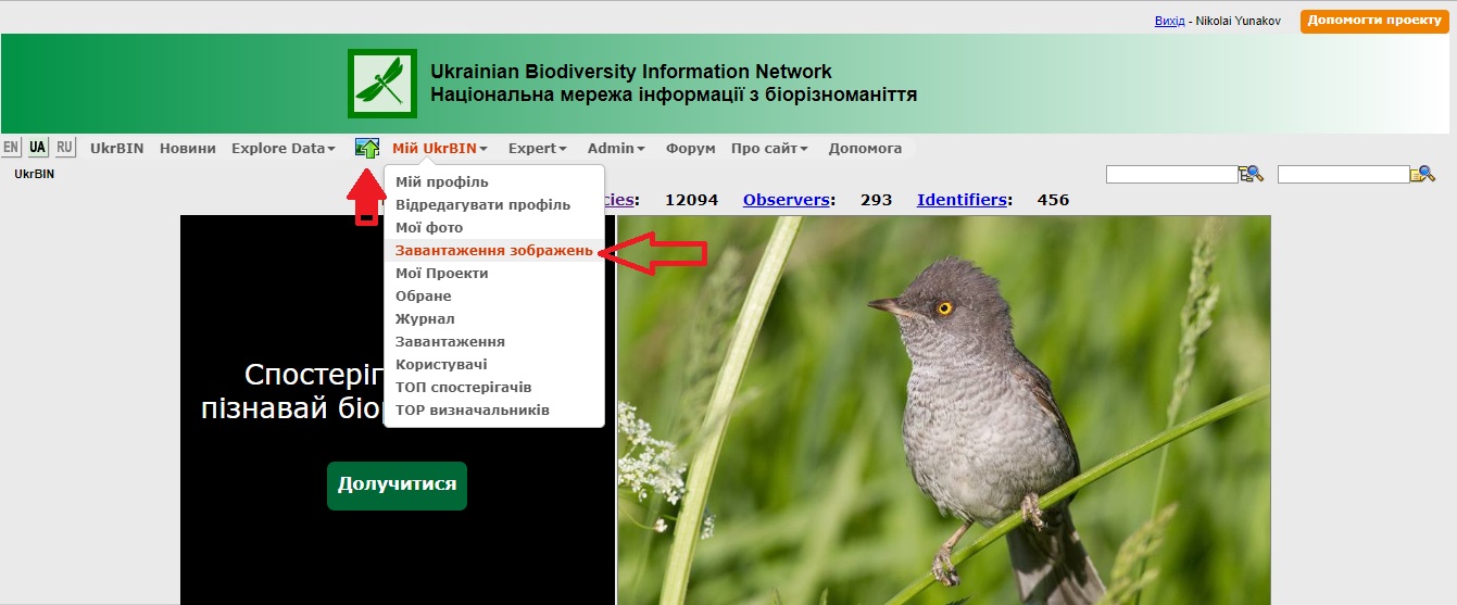


 "Edit" icon
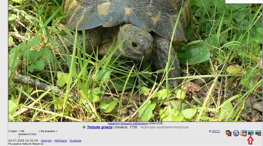


 and go to Taxon Editor of this one and nested taxa
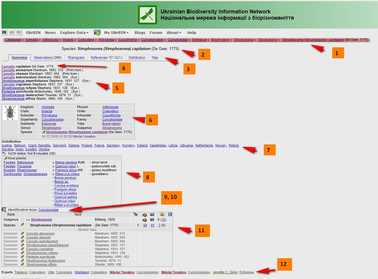
 "Delete Taxon"